From the period that rice-growing was brought to Japan approximately 3,000 years ago, right up to the present day, our ancestors toiled to find a way to grow a large amount of rice on narrow terrain.
Japan is described in the Kojiki, a record of the country’s development into a nation, as the “Country of Lush Reed Plains,” a reference to the bountiful growth of rice and an indication of how rice has symbolized Japan since ancient times.
In this corner, we will introduce you to Toyama’s diverse rice culture through its history, culture, and beautiful natural scenery.
Satta Pass Photograph: SURUGA Marketing & Tourism Bureau The pass is located at foot of Mt. Satta, which juts out into Suruga Bay. The Tokaido Main Line railway, National Route 1, and the Tomei Expressway all intersect here Depicted in the famous painting, “Yui,” one of the fifty-three stations of Utagawa Hiroshige’s Fifty-Three Stations of the Tokaido series, the pass was once a perilous part of the old Tokaido Road.
Located almost in the center of Japan, with an area stretching 155 km east to west and 118 km north to south, Shizuoka Prefecture has an abundance of natural features, including sea, mountains, and lakes. They include the long coastline that stretches some 500 km from the Enshu-nada Sea and Suruga Bay to the Izu Peninsula and the mountain ranges from Mt. Fuji to Mt. Akaishi in the Minami Alps.
With an average temperature of 16°C until recently and annual rainfall of 2,300 mm, which is higher than the national average (about 1,600 mm), if the mountains in the north are excluded, Shizuoka’s climate is classified as a temperate oceanic climate. The prefecture has many dry, sunny days in winter, and snow very rarely falls on the flatlands. For this reason, a wide variety of crops, including rice, have long been cultivated in this region.
Located midway between Edo (Tokyo) and Kamigata (Kyoto and Osaka), this region occupied an important position as a point of contact between Japan’s East and West cultures. In ancient times, it was divided into three provinces, Suruga, Tootoumi, and Izu, each of which nurtured its own lifestyle and culture. Cultural exchange existed not only between East and West, but also between North and South through the Minobu-Kaido route from Suruga to Kofu and the Akiba (Shinshu) Kaido route from Tootoumi to Shinano.
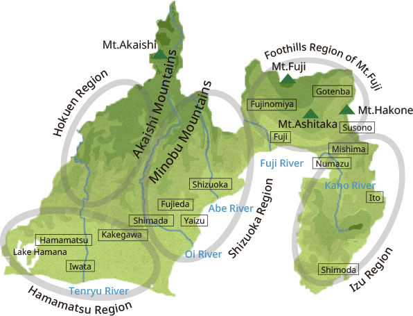
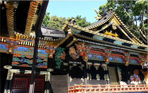
Located in the center of the prefecture, this area was called Sunpu, short for Suruga-Fuchu, because the kokufu, or provincial office of Suruga Province, was located there. This area has long been a key point of transportation between Japan’s East and West. In 1607, Sunpu Castle became the residence of Tokugawa Ieyasu after he retired as Shogun. From that time, the town at the castle’s foot flourished on a par with Edo in the same era. Geographically, the Shizuoka area is famous for the cultivation of commercial crops such as tea and mandarin oranges, taking advantage of the complex landscape that links the northern mountains to the sea. It is also well-known for the abundance of seafood caught in Suruga Bay.
The origin of the name, Tootoumi, lies in the fact that Lake Hamana (Totsu Awaumi; lit: “distant fresh-water lake”) is located far from Kyoto, as opposed to Omi, now Lake Biwa (Chikatsu Awaumi; lit: “near fresh-water lake”), which is close to the ancient capital. Lake Hamana is a brackish lake in which fresh water and seawater mix, where various kinds of fish and shellfish are caught. It also has a lively aquaculture industry, with eel, soft-shelled turtle, and sweetfish farmed in its waters. In this area, a variety of industries, including textiles, musical instruments, and transportation equipment, grew and flourished thanks to the advanced industrial technology that developed from the cotton textile industry of the Edo period. Consequently, the area gave birth to many world-famous companies.
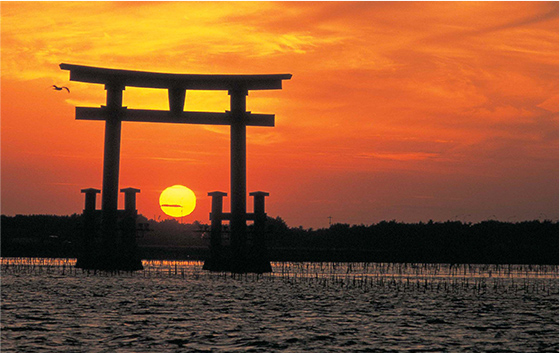
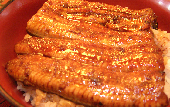
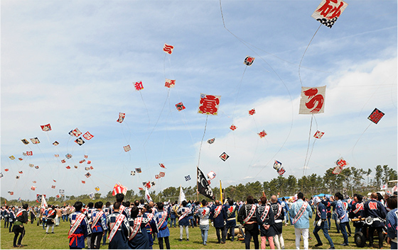
The Izu region refers to the whole of the Izu Peninsula at the easternmost tip of Shizuoka Prefecture. It is formed by the way the mountain range, starting from Hakone, that juts out into the Pacific Ocean Lifestyles and culture that depend on fishing and forestry are practiced in this area, which also has many hot spring resorts with abundant hot spring water. The area was also home to many “wind-waiting harbors” such as Shimoda, making Izu an important transit point for ships en route to Edo.
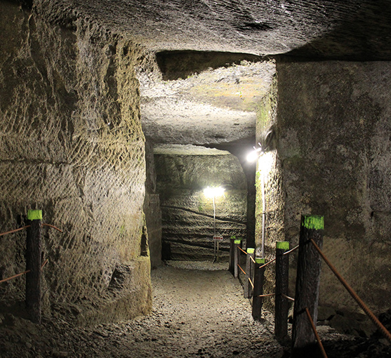
Fuji Sanroku, the area at the foot of Mt. Fuji, is a typical volcanic-ash soil zone, with expanses of broadleaf forest at the higher altitudes. The lower area developed as upland farming fields. During the Edo period, rice paddy development progressed, using the abundant spring water from Mt. Fuji and the Fukara (Hakone) Watergate tunnel.
Although, as an administrative district, the Hokuen area belongs to Hamamatsu City, a different lifestyle from the low-lying areas had developed there since ancient times, and it has a strong tradition of folk culture that has been passed down since the medieval period. Th Hokuen area, the Mikawa area of Aichi Prefecture, and the southern part of Nagano Prefecture, together form a single cultural zone known as “San-shin-en.”
The first baked bread in Japan
Egawa Hidetatsu, the local governor of Nirayama in Izu during the Bakumatsu period. He was known not only for his great administrative ability, but also for demonstrating his talent in a variety of fields, including reforming the military administration for Japan’s coastal defenses, which was an urgent issue at that time. He is also famous as the first person in Japan to bake bread (similar to a hard biscuit), after he noted bread’s usefulness as a portable food for soldiers. In honor of the day he baked that first loaf of bread on April 12, 1842, the 12th of each month has been designated as “Bread Day” in Japan.
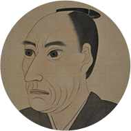
The Egawa family had been a noble family since the Kamakura period (1185–1333). During the Edo period, as hatamoto (direct retainer of the shogun), the family inherited the post of daikan (local governor) of Izu Province, which was a shogunal demesne
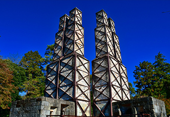
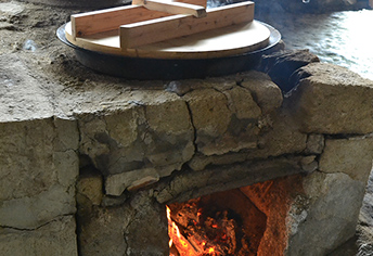
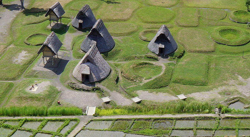
It is believed that paddy rice cultivation was introduced to Japan about 3,000 years ago and had spread throughout this region by around the third century BCE. The Toro Site, discovered in 1943 at a site where a munitions factory was to be built, was the first archeological site in Japan where remains of wet-rice paddy fields were found. As the ruins of a settlement were also found, it has long been considered as a typical farming community of the Yayoi period. It is known that, for 300 years or so from around the 1st century CE, the area was struck many times over by floods, and that the area changed repeatedly from era to era, being rice paddies only in certain periods and rice paddies and settlement at other times.
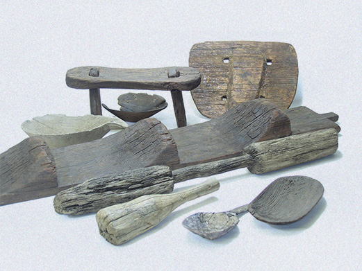
The Yamaki Archeological Site is a complex of ruins from the late Yayoi period to the Heian period, from which many artifacts that describe lifestyle in the Yayoi period have been excavated. They include daily necessities such as earthenware and wooden ware, farming tools, parts of raised-floored buildings and the remains of pit-house dwellings.
The early Edo period was a time when river management and the development of new rice fields were carried out in various parts of the region. One such place was the Fuji River, where a new rice field zone was developed downstream on the left (east) bank of the river with the construction of an embankment called the Karigane-zutsumi. The 2.7 km-long
embankment’s name comes from the way its shape resembles a flock of geese (Karigane) flying in formation.
Furugori Shigetaka started work on the embankment for the development of new rice fields, by building spurs called Ichiban-dashi (First Spur) and Niban-dashi (Second Spur) in 1621. Shigetaka’s son, Shigemasa, was appointed as daikan (local governor) of Kajima to continue the project and fully demonstrated his capability. After Shigemasa’s death, his son,
Shigetoshi, came up with the idea of creating a vast retarding basin to stop the flow of water during floods and weaken the force of the Fuji River. To realize this idea, he built the backward L-shaped embankment in 1674.
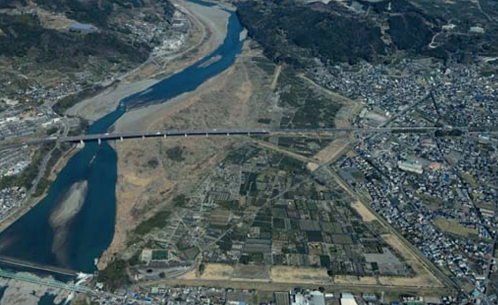
Source: Ministry of Land, Infrastructure, Transport and Tourism Kanto Regional Development Bureau website: https://www.ktr.mlit.go.jp/ktr_content/content/000021651.pdf
In this way, the Karigane-zutsumi took over 50 years to build, amalgamating the efforts of three generations of the Furugori family, enormous costs, and ingenious flood control methods. Since then, the flow of the Fuji River has been stable, and the Kajima Plain, which was protected from flooding, was reborn into a land of abundance known as “the area of Kajima’s 5,000 koku (1 koku = 150 kg) of rice production.”
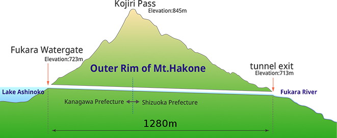
1666 saw the beginning of a massive construction project, in which a tunnel was to be bored through the outer rim of Mt. Hakone to carry water from Lake Ashi to the foot of the mountain on the Shizuoka Prefecture side. The construction work started from both sides of the tunnel, and after four years, Fukara Watergate tunnel was completed. The accuracy of the surveying skills of the times was surprisingly high. After the 1,280-meter-long tunnel was dug from both sides, the margin of error where the two sides met was said to be only about a meter. The Fukara Watergate tunnel is believed to have saved farmers from drought and is still used today to irrigate the fields on the eastern side of the Fuji Sanroku area.
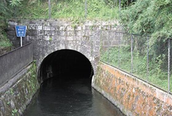
Source: Wikipedia
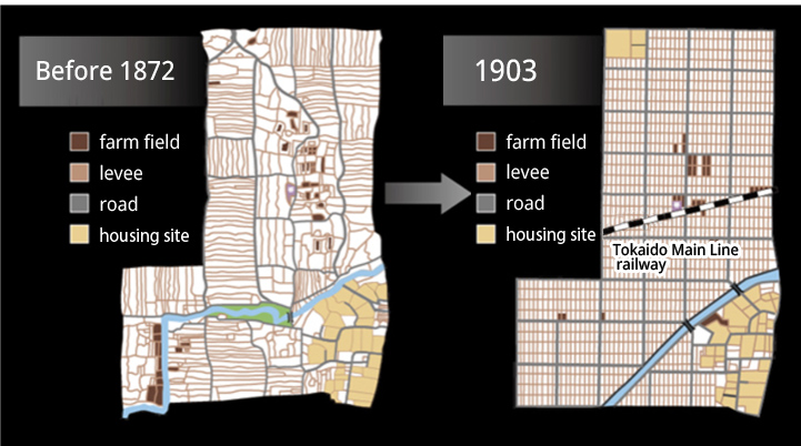
From around the end of the Edo period, a farming method that used horses to cultivate dry-paddy fields was introduced in various places, with the aim of producing higher yields. A prerequisite of this new method was the consolidation of the cultivated land. Prior to the revision of rice fields in 1887 and the enactment of the Farmland Consolidation Act in 1899, the Shizuoka-style Land Consolidation was implemented by Tarouma Nagura. In 1872, Nagura improved the curved roads and ridges of his paddy fields to create a paddy plot with straight lines. Straightening the paddy fields brought many benefits. They included improved efficiency of cultivation and weeding, smoother water supply and drainage, and less pest damage thanks to better ventilation. Of course, yields increased as well, and in the following year, 1873, with the support of the villagers who had seen the results of Nagura’s efforts, farmland consolidation started in all farmland in Hikoshima Village (today’s Fukuroi and Iwata Cities), an area of just under 44 hectares.
Shizuoka Prefecture is composed of the mountainous regions that line the Southern Alps and Mt. Fuji in the north, the hilly regions at the foot of the mountains, and the plains that stretch out below. An expanse of rice paddies stretches out on the plains along the prefecture’s long coastline. It has existed since ancient times, as evidenced by the Toro Site. The slash-and-burn farming culture, typically used for the production of taro yams, buckwheat, and barley, can still be found in the mountainous areas in the north. The prefecture could be described as a region in which paddy farming, which was adopted early in the temperate areas, and mountain farming in the areas of severe cold, in other words, Yayoi culture and Jomon culture, co-existed until recent times. Fishing grew and developed as an industry from early times on the coastline of Izu Peninsula and around the Lake Hamana.
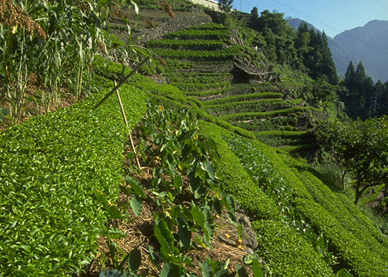
Terraced fields in the mountain area
(Misakubo Town)
-
Mizukakena (Tona)
(Foothills Region of Mt.Fuji)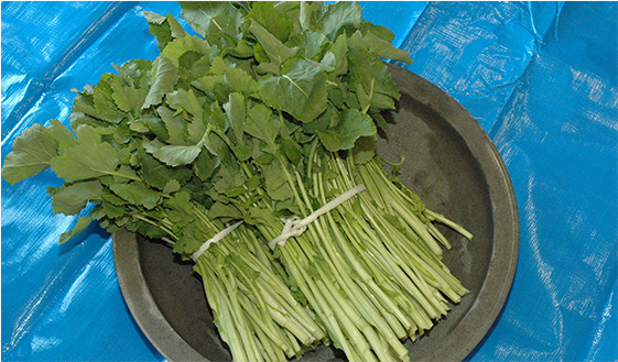
Grown with abundant spring water around the foot of Mt. Fuji.Photograph: JA Gotemba
-
Tengusa Gathering
(Izu Region)
Dried tengusa (gelidiaceae algae) was shipped as an ingredient for agar, providing a valuable source of income.Photograph: Tourism and Commerce Department, Industry Division, Izu City Hall
-
Mullet dishes
(around Lake Hamana)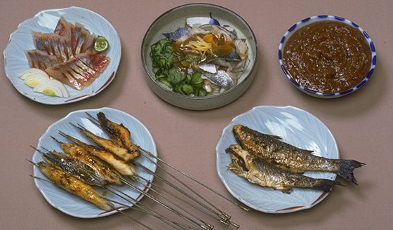
During the era of Japan’s rapid economic growth, when there was a serious problem with water pollution, mullet had a reputation of being “smelly”, but it actually tastes delicious.Rural Culture Association Japan collection
Large rivers such as the Tenryu, Oi, and Abe Rivers, as well as the Fuji River, fostered both upstream and downstream lifestyle cultures, but on the other hand, they were also a major obstacle to cultural exchange between the east and west of the country. Food culture is also divided between East and West by the Oi River, which flows between Suruga and Tootoumi. Their cultural characteristics become gradually more distinct from each other the further east or west one progresses. The Oi River is both the dividing point between the cultures of East and West and the junction where they meet.
-
Onigiri and Omusubi
Rice Balls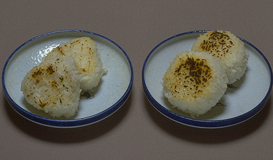
The shape of onigiri rice balls is more commonly round on the east side of the Oi River and triangular on the west.
-
Zoni Soup (Left: Kansai style, Right: Kanto style)
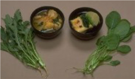
Generally, round mochi (dried rice cake) is placed in zoni soup as is in the Kansai region (west Japan), but in Kanto (east Japan), kirimochi (mochi cut into rectangular shapes) is first grilled before being placed in the zoni soup. The vegetables included also differ, with Kyona (potherb mustard) often used for Kansai-style zoni and Komatsuna (Japanese mustard spinach) for Kanto-style.
-
Hamana Natto and Kinzanji Natto
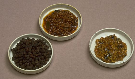
The natto most commonly eaten in western Japan is fermented with koji mold (Aspergillus oryzae), unlike the itohiki or sticky natto that is often eaten in Shizuoka and eastward.
Photos: Rural Culture Association Japan collection
Izu is blessed with a temperate climate and an abundance of spring water, making it the perfect location to grow shiitake mushrooms and wasabi. The first artificial cultivation of shiitake mushrooms in Japan is said to have occurred in Izu in 1741. Izu has about 200 days a year that are ideal for growing shiitake mushrooms, more than any other production
area. This allows them to be grown at a slower pace to produce the thick mushrooms known as “Donko,” which are shipped from Izu.
Wasabi cultivation is thought to have started in 1744, when a man called Itagaki Kanshiro, who visited Suruga to instruct the locals on shiitake cultivation, also introduced wasabi cultivation techniques. During the Bunka and Bunsei era (1804-1830), nigiri-zushi, which originated in Edo, rapidly became popular, leading to a sharp rise in demand for wasabi,
which became a major source of income for the Izu region.
From the Meiji period onward, shiitake mushroom exports to China expanded, and even today, shiitake mushrooms from Izu are valued for their high quality. Wasabi from Izu has the top share of the domestic market in terms of handled volume.
-
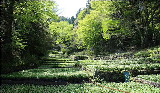
Wasabi Fields in Ikadaba (Izu City) Photograph: Tourism and Commerce Department, Industry Division, Izu City Hall A cultivation method known as tatami-ishi style uses spring water, which is in abundant supply and has stable water temperatures. The birthplace of wasabi cultivation is said to be Utogi in Shizuoka City. Wasabi farming is also popular at the foot of Mt. Fuji, where spring water is in abundant supply, and at the upper reaches of the Abe and Oi Rivers, which have their sources in the Southern Alps. In 2018, the traditional cultivation of wasabi practiced in three cities and four towns, including Izu City, was designated as Globally Important Agricultural Heritage System. -
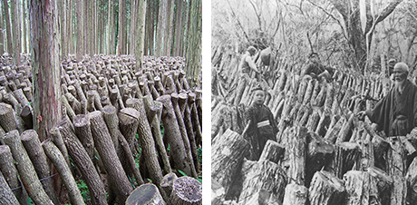
Gassho-style Shiitake Cultivation Photograph: Shizuoka Prefecture Eastern Agriculture and Forestry Office A method of assembling raw wood into steep rafters devised by Hideo Ishiwata, an expert in shiitake mushroom cultivation in the Meiji period (grey-haired man at right in photo), with the aim of improving ventilation and efficiency of harvest.
With the restoration of Imperial rule in 1867, the last shogun, Tokugawa Yoshinobu, moved to Sunpu. At the time, the Seieitai (later known as Shinbangumi), an elite squad that guarded Yoshinobu, also relocated to Sunpu. However, when the daimyo (feudal lords) voluntarily returned their lands and people to the Emperor in 1869, the Shinbangumi was suddenly disbanded, and the guards lost their jobs. These shogunate vassals of the Shinbangumi, led by Kageaki Chujo, decided to lay down their swords and take up tea farming on the Makinohara Plateau. Since the opening of the ports in 1859, tea had become a promising export product, and the Makinohara Plateau, an elevated area of land with good drainage and acidic soil, was an excellent location for growing tea.
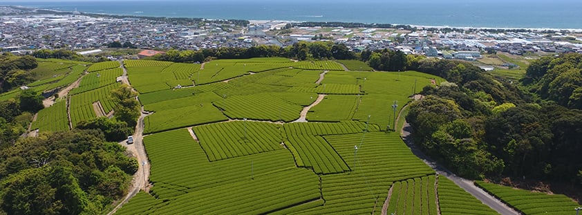
In 2013, the “Traditional Tea-grass Integrated System in Shizuoka” (Chagusaba) practiced in four cities and one town, including Makinohara City, was designated as a Globally Important Agricultural Heritage System. Chagusaba is a traditional agricultural practice in which grasses such as Japanese silver grass and sasa broadleaf bamboo that grow around the tea plantations (“chagusa”) are cut and spread on the furrows underneath the tea bushes. These chagusa are said to improve the taste and aroma of the tea. The grassland environment maintained and managed by humans in this way is referred to as "semi-natural grassland" and provides a home for more than 300 species of plants and animals.
However, the plateau was suffering from a serious water shortage. Not only was there not enough water to grow and replant seedlings, but there was also not enough to meet the needs of everyday life. Furthermore, these former samurai were amateurs when it came to farming, and it is said that they experienced a series of hardships and failures in the beginning. Chujo and his colleagues persisted in their efforts to develop the land, and in 1873, four years after they started, their first tea harvest finally took place. While a growing number of the samurai group started to leave the land, laborers who had worked the Oi River crossings, who had also lost their jobs, and neighboring farmers started to join the development effort, and by 1890, the area of the tea fields had expanded to just under 600 hectares. Chujo, who had continued in his passionate determination to develop the tea fields, passed away in 1896 at the age of 70, entrusting the next generation to carry on his work. In the midst of such massive historical changes, the Makinohara Plateau became one of the leading tea production areas in the prefecture.
Due to the area’s mild climate, its new tea can be enjoyed in mid-April. Makinohara brand tea produced by the Fukamushi-cha (deep-steamed green tea) method has many distinctive features, including is bright dark-green color, rich aroma, and mild taste, which is less bitter and astringent than other teas.
Hamamatsu, the Town of Gyoza
According to the 2020 Family Income & Expenditure Survey, per-household purchases of gyoza dumplings in Hamamatsu City have returned to number one in Japan for the first time in two years. Hamamatsu City maintained the top rank for three consecutive years until 2016, but in recent years, it has competed with Utsunomiya City for the top spot. The average household in Hamamatsu spent 3,766 yen on gyoza in 2020, followed closely by 3,693 yen in Utsunomiya city and 3,670 yen in Miyazaki City.
It is said that, for many of the Japanese towns that are famous for gyoza in Japan, the reason is that people who returned from Manchuria after World War II introduced gyoza in their hometowns and made them popular. Hamamatsu gyoza are made with pork mince from the thriving local pork industry and locally grown cabbage and onion. They have a distinctive flavor that is both light and rich at the same time and are usually served with bean sprouts as a side dish.
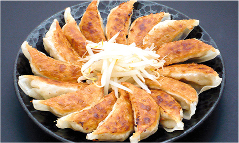
Photograph: Hamamatsu & Lake Hamana Tourism Bureau
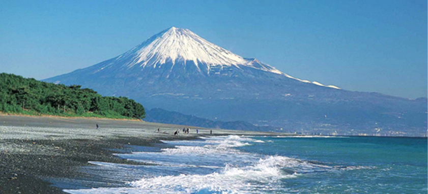
Suruga Tourism Association
Miho no Matsubara, a pine grove on the east coast of the Miho Peninsula that extends from Shimizu Port into Suruga Bay, has been known as a spot of scenic beauty since ancient times. In 2013, the pine groves were registered as part of the World Heritage Site, “Fujisan, sacred place and source of artistic inspiration.” In the pine grove, the setting of the Noh play, Hagoromo, a Japanese black pine known as Hagoromo no Matsu, believed to be 650 years old, stretches out its branches.
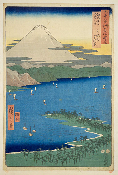
The National Diet Library collection
In the past, the environment of the coast of the Enshu-nada Sea was extremely harsh, with its sand beaches enlarged by large amounts of earth and sand from the Tenryu River and the intense Enshu no karakkaze (dry winds from the mountains) blowing from the southwest, exposing the coast to large volumes of flying sand. Since the end of the Edo period, embankments and coastal forests have been established in a diagonal direction, redirecting the strong winds and flying sand toward the sea, thus stabilizing the environment of the hinterlands and allowing them to be used as farmland. Those coastal forests have been developed in multiple layers for over a century, and the parts that still remain extend for a length of over 50 km. Fields have been cultivated between the forests, where sweet potatoes, carrots, etc., are grown.
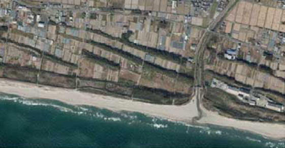
of Enshu-nada Sea
(Omaezaki City, Kakegawa City)
Photograph: Shizuoka Prefecture
It was after the middle of the Edo period that cotton cultivation spread throughout Japan. In particular, Enshu (Tootoumi Province) produced good quality cotton, alongside Senshu (Izumi Province, the southwestern part of Osaka Prefecture) and Mikawa (the eastern part of Aichi Prefecture). Cotton fabrics that were hand-woven by cotton farmers were sold, but in 1845, the lord of the Hamamatsu Domain promoted machine weaving as a side job for his retainers, which led to the further development of cotton fabrics. The characteristic vertical stripes eventually came to be known as "Enshujima.” The automatic loom invented by the founder of Toyota, Sakichi Toyoda, in 1886, dramatically boosted production. The land of Enshu, where advanced technology and craftsmanship were cultivated, would later lead to the birth of global manufacturers of motorcycles, automobiles, and musical instruments.

Yoshuku Geino (Preliminary Celebration Performing Arts) is kind of dance that depicts the process of growing rice. It is performed in front of Shinto and Buddhist deities to pray for a good rice harvest. Many of these performances take place on New Year's Day, and the performances vary from place to place. In some areas, they stop at the scene of rice planting, while in other areas, the performance goes as far as harvesting the rice.
Fujimori no Ta-Asobi is a local performing art with a tradition of more than 1000 years, said to have first been performed to the deities as far back as 985. It depicts the entire process of rice cultivation from the reclamation of land to the harvest. As a preliminarily celebration of a bountiful harvest, Ta-Asobi has been passed down over the centuries almost completely in its original form. Young men dressed up as women, dance with umbrellas decorated with flowers and brightly-colored sashes. The Mandoka headdress that forms part of the costume for the Saru Dengaku dance is said to imitate cherry blossoms.
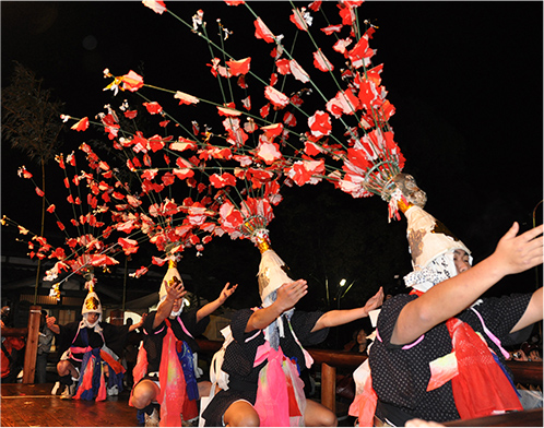
Photograph: Yaizu City History and Folklore Museum
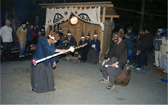
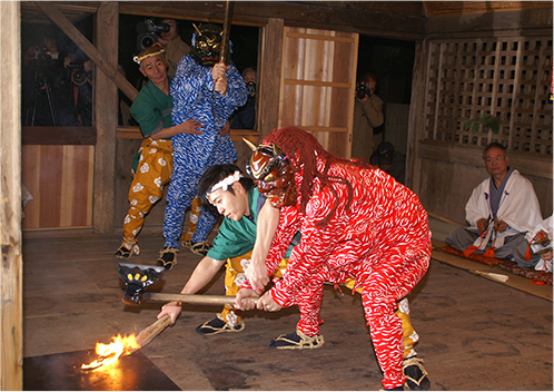
Okunai, which evolved from the Shusho-e (prayer for peace and security of the nation and good harvests) conducted by Buddhist temples, and Hiyondori, which is a corrupted pronunciation of hi-odori, or fire dance, and forms part of the Okunai rite, are performed in temples and shrines in Hamamatsu City at the beginning of New Year.
Terano Hiyondori, Kawanano Hiyondori, and Futokoroyama Okunai are designated as National Important Intangible Folk Cultural Property as "Hiyondori and Okunai of Tootoumi."
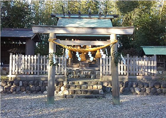
From ancient times, Akiha Shrine prospered as a sacred place for the practice of Shugendo, Japanese mountain asceticism incorporating Shinto and Buddhist concepts, with Hinokagutsuchi-no-Okami, the kami of fire prevention, as its enshrined deity. It was a place of deep worship for samurai families. In the Edo period, the shrine was worshipped in castle towns as a god to prevent catastrophic fires. It was particularly revered by the townspeople of Edo, which suffered frequent fire tragedies. The current name of Akihabara in Tokyo’s Chiyoda-ku is derived from the fact that Akiha Shrine’s deity was invited to transfer to that location to pray for the prevention of fire in Edo. Akiba Kaido Road, which runs north to south through Akiha Jinja Shrine and is also called Shinshu Kaido Road, was a route that many people and goods passed through.
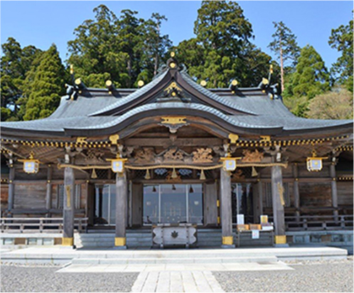
Photograph: Akiha Jinja Shrine
The whole of Mt. Fuji, Japan’s most famous mountain, was a “kami” or deity in itself. From the 8th to the 11th centuries, there were repeated major eruptions of Mt. Fuji. Believing that this was due to the wrath and terror of the kami, the people deepened their worship. Later, the god of Mt. Fuji, Sengen Okami, syncretized with Buddhism and came to be called Fuji Gongen or Fuji Sengen Daibosatsu. In the Edo period, pilgrimage groups for visiting Mt. Fuji, known as “Ko,” formed in various locations, and miniature "Ofuji-san (Mt. Fuji)" mounds were erected in the town of Edo as protective deities.
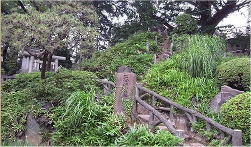
Believed to have been erected in 1789, this mound is a recreation of Mt. Fuji from the granite village shrine (Asama shrine) at the foot of the mountain to the Oku-no-Miya (rear shrine) at the summit
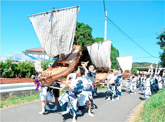
The Ofune Shinji ritual handed down at Oe Hachimangu Shrine is said to have started in the middle of the Edo period, when a ship wholesaler from Sagara Minato prayed for safe voyages and prosperity in business. The boat used for the ritual, which is about 2 meters long, is an elaborate replica of Higaki Kaisen and Taru Kaisen, the cargo ships of the Edo period. Young men, called Funawaka, carry the Ofune (miniature ship) on their shoulders and parade through the Oe district at the head of a Togyo Procession.
The three bugaku court dance and music traditions of the region, Twelve-Step Bugaku of Okuni Jinja Shrine, Twelve-Step Bugaku of Amenomiya Jinja Shrine, and Tenno-sai Bugaku of Yamana Jinja Shrine, are collectively known as "Tootoumi Morimachi Bugaku” and are designated Important Intangible Folk Cultural Properties. They are examples of how the performing art of bugaku spread to the regions and became firmly established in local folk traditions. It is believed that the bugaku of Okuni Jinja Shrine and Amenomiya Jinja Shrine are localized forms derived from the bugaku of Kasuga Jinja Shrine in Nara, whereas Yamana Jinja Shrine’s bugaku is a typical example of bugaku taking on a more refined form.
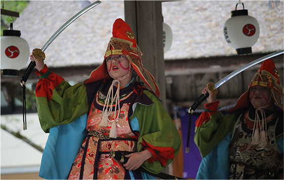
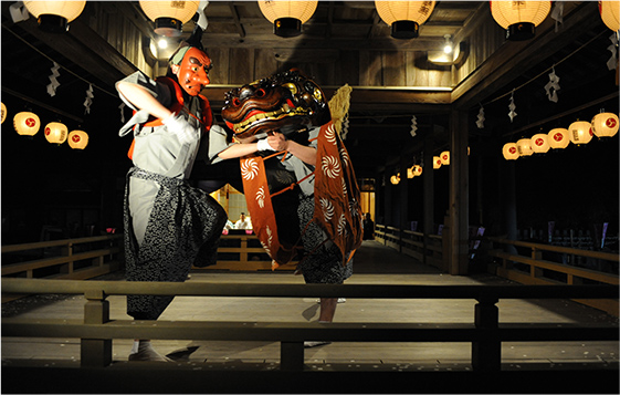
Photos provided by Okuni Jinja Shrine
Shipping that connected Edo and the rest of the nation
Before the development of railway networks, transportation by ship was the main way of efficiently transporting goods in large volumes. In the Edo period, along with the need to establish routes for efficiently transporting the annual rice taxes from various parts of the country and the increase in the volume of goods being transported from Osaka, the economic center of the time, to Edo, the city of mass consumption, navigation routes connecting the entire country were established, developing into important infrastructure that supported the economy of the Edo period. Between Edo and Osaka, Higaki-kaisen ships, which began with transportation of daily necessities, Taru-kaisen ships, which were dedicated to sake transportation, and a network of wholesalers that controlled those goods developed. On the Sea of Japan side, the Kitamae-bune shipping route was used to connect Ezochi (Hokkaido) and Osaka, while on the Kanto Plain, riverboats plying the Tone and Arakawa Rivers were more popular than land transportation.
In those times, Shimoda, in Izu, which flourished as a “wind-waiting harbor” for ships to shelter while waiting for favorable winds, was a key port for ships heading to Edo. The stretch from the port of Toba in Shima (Mie Prefecture) to the Izu Peninsula was considered to be a difficult part of the route, with no good harbors to avoid strong winds and waves.
However, if a ship was blessed with favorable winds, it could make it across this section in only a day. In 1670, Kawamura Zuiken established the Northeast navigation route, and ships loaded with goods from the Ezochi and Tohoku regions began to sail south down the Pacific coast.
The wind and tidal conditions of the Boso Peninsula from Choshi to Kujukuri and Nojimazaki were difficult, and it was dangerous to enter Edo Bay directly from there. For this reason, ships sometimes crossed Sagami Bay and entered Shimoda Port, where they waited for favorable winds before heading to Edo. In this way, Shimoda attracted many ships and became a busy and prosperous port.
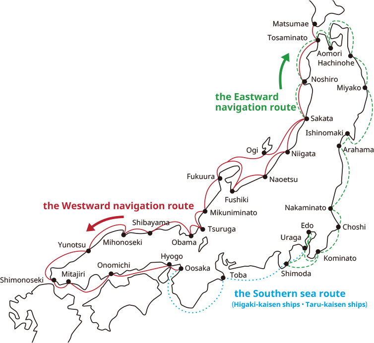
Shipping Route Chart


